
About
Contents
About#
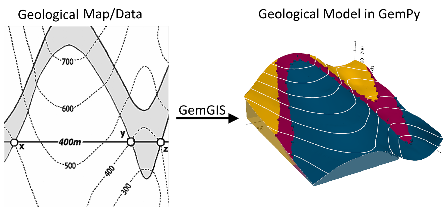
GemGIS is a Python-based, open-source geographic information processing library. It is capable of preprocessing spatial data such as vector data (shape files, geojson files, geopackages,…), raster data (tif, png,…), data obtained from online services (WCS, WMS, WFS) or XML/KML files (soon). Preprocessed data can be stored in a dedicated Data Class to be passed to the geomodeling package GemPy in order to accelerate the model building process. Postprocessing of model results will allow export from GemPy to geoinformation systems such as QGIS and ArcGIS or to Google Earth for further use.
GemGIS uses and combines the full functionality of GeoPandas, rasterio, OWSLib, Pandas, Shapely, PyVista and NumPy to simplify, accelerate and automate the workflows used to preprocess spatial data for geomodeling.
Deployment |
|
GitHub |
|
Binder |
|
License |
|
Documentation |
|
Github Workflow |
|
Issue Tracking |
|
Pull Requests |
|


Content#
This documentation page consists of a Getting Started section with information about Authors, Citation, License, how the Installation (Tested 2023-09-01) of GemGIS works, which Data Types are supported and which packages are included in GemGIS and most importantly for new users Tutorials and Basic Usage and Examples.
The API Reference section provides information about the different functions, that are implemented in GemGIS. This includes the GemGIS Data Object, Working with Vector Data, Working with Raster Data, Working with Online Services, different additional Utility Tools, Visualization and Plotting, different other methods not so frequently used or for specific cases under Miscellaneous and last but not least Postprocessing of GemPy Models.
Each set of functions is collected in a different module. The functions of each module can be accessed as followed:
import gemgis as gg

data = gg.vector.function_name(...)

data = gg.raster.function_name(...)

data = gg.visualization.function_name(...)

data = gg.web.function_name(...)

data = gg.utils.function_name(...)

data = gg.misc.functions_name(...)
Video Tutorials#
There will be tutorial videos posted soon on YouTube where we will interactively explain the story behind GemGIS, walk through the installation process, introduce the different utilized packages and introduce the functionality of the different functions implemented in GemGIS.
Support#
For general questions about the project, its applications, or about software usage, please create an issue in the cgre-aachen/gemgis repository. The community will then collectively address your questions. The developers of GemGIS can also be reached on the Software Underground Slack Workspace.
Citing GemGIS#
If you are using GemGIS for your scientific research, please remember to cite our work. The citation is provided in the Authors, Citation, License section.