
What is a mesh?
Contents
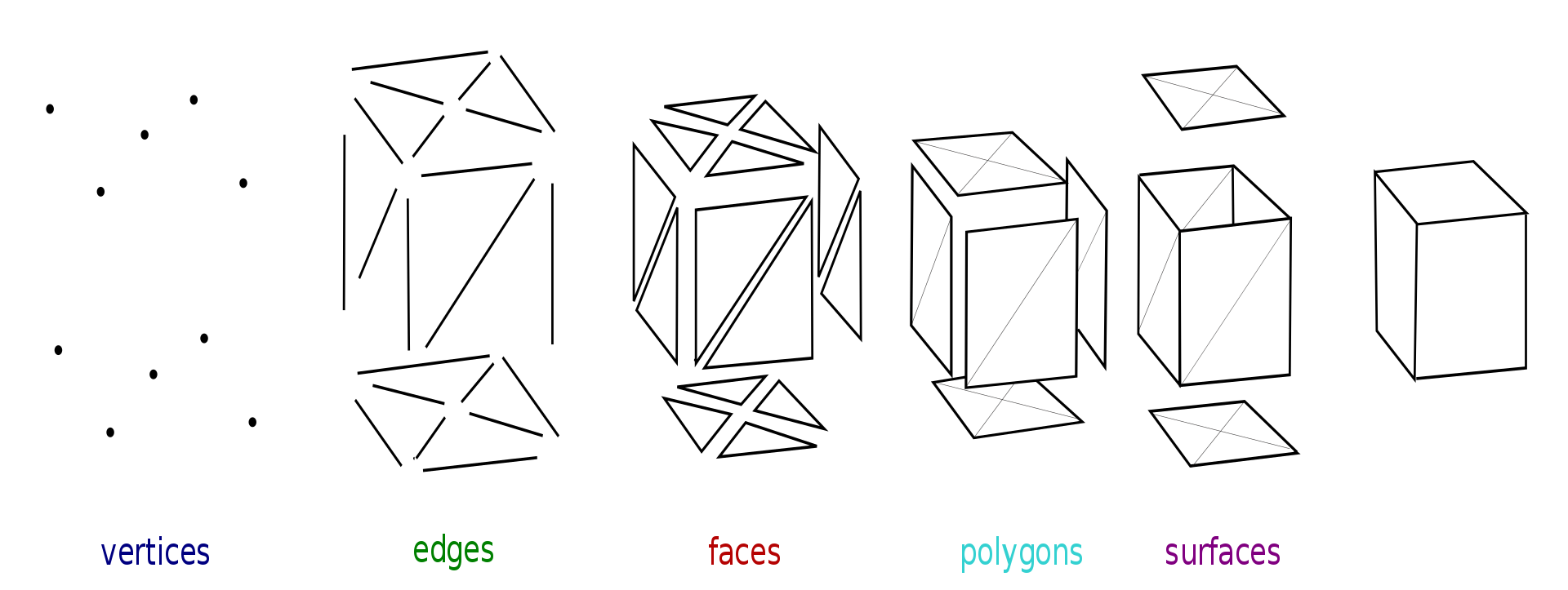
What is a mesh?#
A mesh is a collection of vertices, edges and faces that defines the shape of a polyhedral object.
Vertices: Representing the x, y and z coordinates/position of corner points of the mesh
Edges: Representing the straight/linear connection between two vertices
Faces: Representing a closed set of edges. Three edges/vertices make up a triangle, four or more make up a polygon. Both polygons and triangles are coplanar, indicating that are located in the same plane.
Surfaces: Representing a collection of faces making up a non-coplanar surface.
Source: https://en.wikipedia.org/wiki/Polygon_mesh
Working with mesh data in GemGIS#
Mesh data is one of the fundamental data types used in GemGIS. Mesh data is handled by the PyVista package.
PyVista can work with PolyData objects and grids (StructuredGrid, UnstructuredGrid) consisting of cells and points. Data arrays can be associated with the object holding information such as elevation or depth values, labels or in case of MultiBlock data the single blocks.